Difference between revisions of "Tuam Hole"
m (Reverted edits by CarmelaShields (talk) to last revision by Seanie) |
|||
| Line 12: | Line 12: | ||
== Access == | == Access == | ||
| − | Put on around the back of the petrol station and drop on from upstream. The land owner does not want anyone climbing the wall on the upstream side of the bridge and putting on there as he has had problems with kids drinking there after seeing paddlers gain access that way | + | Put on around the back of the petrol station and drop on from upstream. The land owner does not want anyone climbing the wall on the upstream side of the bridge and putting on there as he has had problems with kids drinking there after seeing paddlers gain access that way. He has no problem with paddlers using his land to access the feature from upstream so please only use this put on. |
Get off is directly below the bridge on river left. There is a clear path up the bank that will bring you back to the car park. This can also be used as a put on but on high flows it is a tough paddle up through the bridge. | Get off is directly below the bridge on river left. There is a clear path up the bank that will bring you back to the car park. This can also be used as a put on but on high flows it is a tough paddle up through the bridge. | ||
Latest revision as of 15:58, 10 October 2012
Brief feature description
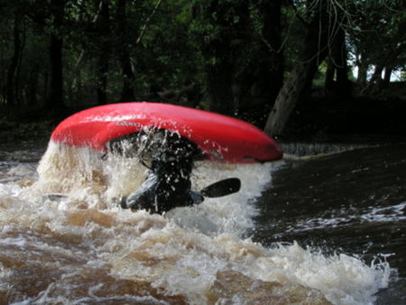
This is a great "Park&Play" spot situated on the Clare River Co.Galway. Perfect for the beginner learning how to side surf to the expert learning Phonix Monkeys or combo moves. The feature is 20 feet wide so plenty room for party holes.
The feature changes depending on the difference between the upstream and downstream level going from a flushy to a retentive hole ,however it will never hold a boat or swimmer. At perfect levels it is a copy of the inlet gate hole at hpp.
Location
Just outside of Tuam town centre on the R322 road to Ballinrobe. [1] Parking is suitable opposite the closed down petrol station in a large unofficial car park.Hole can be viewed from the downstream bridge.
Access
Put on around the back of the petrol station and drop on from upstream. The land owner does not want anyone climbing the wall on the upstream side of the bridge and putting on there as he has had problems with kids drinking there after seeing paddlers gain access that way. He has no problem with paddlers using his land to access the feature from upstream so please only use this put on.
Get off is directly below the bridge on river left. There is a clear path up the bank that will bring you back to the car park. This can also be used as a put on but on high flows it is a tough paddle up through the bridge.
Required Conditions/Levels
It will take a few days of rain to come up after a dry spell but during winter months a day of decent rain should bring it up. Once up it usually holds out for a few days. There is an online gauge for the feature but at the moment it does not give accurate measurements. If in doubt throw up a post on the NUIGKC forum and someone should be able to give you a good idea of the level.
.9 on the gauge by hole is generally the minimum level while once it gets above 1.8 it starts turning into a small flushy wave.
Note: The online gauge is not calibrated to the gauge at the hole. Generally 1.4 on the online gauge is .9 at the hole.
More Info & Tips
Tuam is the coldest spot around so bring a skull cap. Video.
